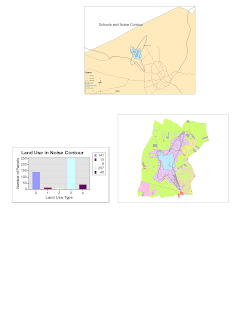
Map 1: Step One Completed

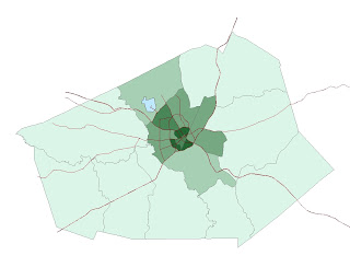
Map 2: Phase 2 Completed

Map2: Phase 3 Completed

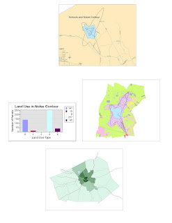
Map4: Phase 4 Completed


This lab introduced me to ArcMap as I plunged into a tutorial illustrating the numerous possibilities incorporated in the software’s data. While constructing the airport maps, I became somewhat familiar with the basic functions of GIS and finally began to understand what he program does and how it’s tools aid geographers. Once the project was complete, apart from feeling proud of myself (I did spend a good 8 hours getting to know the program), I understood how GIS could be used by anyone and how vital it is for our society.
The biggest potential of GIS and ArcMap would be the tool bars, cursors, options and hundreds (if not thousands) of controls which the user has available to manipulate while working on his/her map. This allows the maker to fully customize the end result and fine-tune it so it suits the purposes as hand. With this activity, for example, I was able to show not only the noise level areas, the schools, the roads and the overall surrounding area affected; I was also capable of making a graph as well as “zooming” out and demonstrating the whole county and geographic location of the project. Thus GIS makes it easy for the viewer to quickly grasp the content before him/her and analyze the data intelligently.
I was also impressed with the system’s ability to incorporate and store statistical data. I do, however, think that this could be a potential pitfall as greater generalization may be made about a certain geographical area. Since statistics can never be 100% accurate and sometimes comes out quite faulty, GIS may not always produce an accurate. Yet as we learned in class, because the system can always be updated and information can always be changed, these mistakes can swiftly be altered for the better.
Thus far, I find the software intimidating and fun. The potential to store so much information and then neatly and cohesively display it so the average person understands the “bigger picture” is amazing. I do think that the program is honed for specialists, as would be in any given field and its tools, because I struggled immensely throughout the tutorial and, noting all the sighs and raised hands for help, so did the rest of the class. GIS may be a tool which could only be truly used with its maximum potential via professionals. I liked that when placing the mouse over any function a description would pop up. Even so, the average “Joe” would have a tough time using the software.
In this lab I understood that GIS is broadly used by all professions on a daily basis. Never having heard or used the software before, I was surprised that with enough effort I too could create a pretty neat looking poster with valuable information pertaining to a certain land area. I’m anxious to see what is next in this new section of the world of geography. In time, I hope that I will confidently use ArcMap and have the competence to carry on a conversation with a professional in this field. I also hope that my map skills and overall orientation of location greatly improve.


No comments:
Post a Comment